ETUDES TOPOGRAPHIQUES ROUTIÈRES POUR LE DÉVELOPPEMENT DE LA BOUCLE MINIÈRE DU DJA - CORRIDOR AKONOLINGA - BENGBIS (40KM)
ETUDES TOPOGRAPHIQUES ROUTIÈRES POUR LE DÉVELOPPEMENT DE LA BOUCLE MINIÈRE DU DJA - CORRIDOR AKONOLINGA - BENGBIS (40KM)
La fiche détaillée de ce projet sera publiée prochainement.
Localisation
Situer le projet
Le point focal du projet sur fond cartographique. Coordonnées géodésiques relevées sur site.
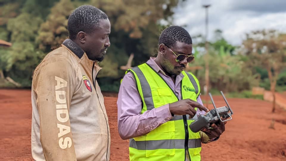
Galerie
Le projet en images
Un projet comparable à mener ?
Études topographiques, contrôles d'ouvrages, photogrammétrie par drone : parlons de votre besoin.
Continuer l'exploration
Projets similaires
- Infrastructures RoutièresJuillet 2025
Route Garoua-Mokolo-Kourgui (276 km) + Pont Logone — variante
Variante du dossier n°59 — même corridor 276 km + pont sur le Logone.
Voir le projet 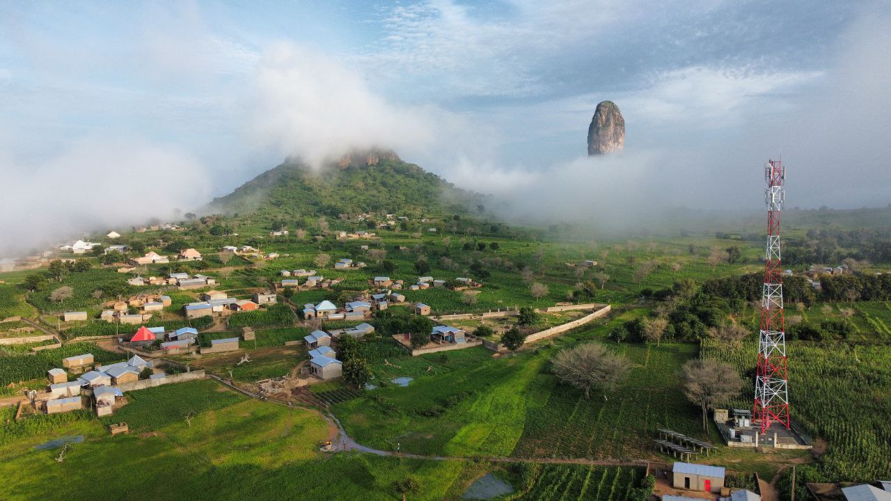 Infrastructures Routières10 Juin 2025 - Décembre 2026
Route Garoua-Dourbeye-Bourha-Mokolo-Kouyapé-Kourgui (276 km) + Pont Logone
Corridor Garoua (région du Nord) - Kourgui (région de l'Extrême-Nord) | Linéaire/superficie : 276 km /5520 ha | 01 Barrage (PKXXX - Goloza) | xxxx 10 Ponts | 200 Ouvrages Dalots & buses | 220 800 000 nuages de points topographiques (4points/m²) | 120 Bornes béton posées | xxxxxxxxx semi de points topographiques
Voir le projet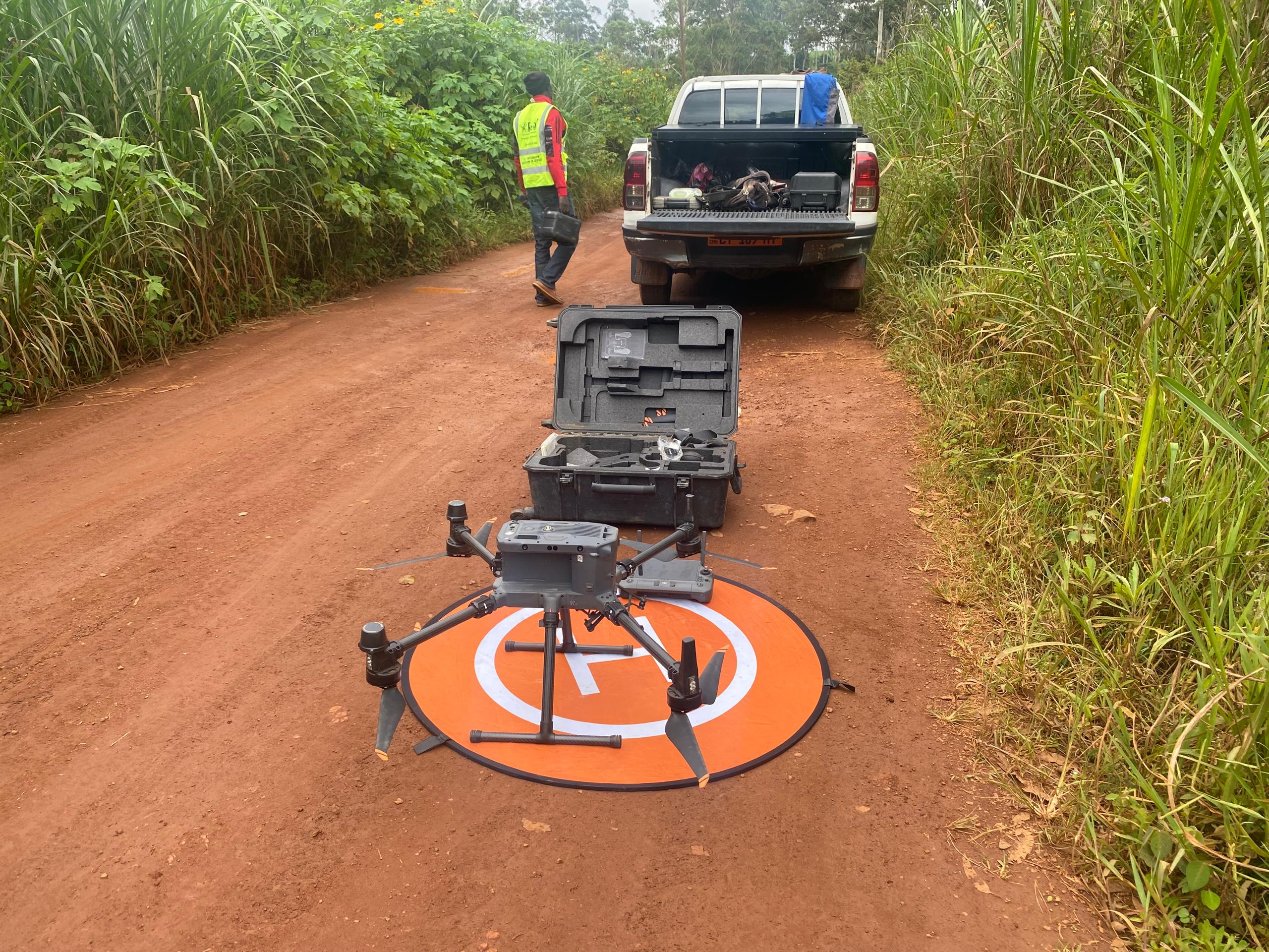 Infrastructures RoutièresAvril 2025 - Décembre 2026
Routes Dschang-Fomopea-Bandja-Kekem et Bafoussam-Bameka-Batié (122 km)
Linéaire total 122 km — 2 corridors routiers dans la région de l'Ouest.
Voir le projet- Infrastructures RoutièresMars 2025
Routes Nemeyong III-Messok (32 km) et Akonolinga-Bengbis (40 km) — PADI-DJA
Programme d'aménagement de la Boucle Minière du Dja — 72 km total.
Voir le projet - Infrastructures RoutièresMars 2022
Bitumage Assok-Essabah-Nkogoa (3,5 km) — Mfou
Études d'exécution topographiques — enduit superficiel tricouche — 3,5 km.
Voir le projet - Infrastructures RoutièresFévrier 2022
Route Yaoundé-Bafoussam-Babadjou — Lot 1 Pont Ebebda + Échangeur Obala (63,75 km)
Réhabilitation Lot 1 — Pont d'Ebebda-Kalong + échangeur du carrefour Obala — 63,75 km.
Voir le projet - Infrastructures RoutièresSep-Déc 2021
Route Bafia-Ngoro (30 km)
Études topographiques pour la construction de la route nationale Bafia-Ngoro — 30 km.
Voir le projet - Infrastructures RoutièresJuin 2021
Route Batchenga-Ntui-Mankim-Yoko-Léna + Pont Sanaga
Contrôle & surveillance — route Lot 1 + Pont sur la Sanaga sur l'axe Batchenga-Ntui.
Voir le projet - Infrastructures RoutièresJuin 2019-Oct 2020
Voie de Contournement de Yaoundé (70 km) — APS/APD/DCE/EIE
Études techniques APS/APD/DCE + EIE — autoroute de contournement de la capitale — 2 phases.
Voir le projet